Exposants
Découvrez les dernières solutions et technologies géospatiales.
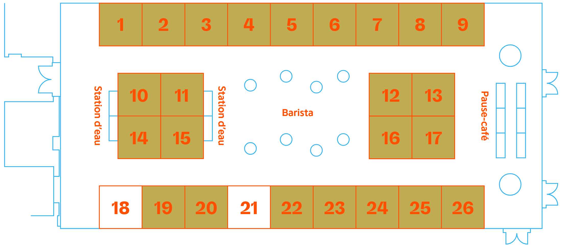
Plan de la salle
Zone exposition — GeoMTL 2027
Esri Canada
Plateformes SIGDécouvrez les dernières nouveautés ArcGIS Pro, ArcGIS Online et les solutions Field Maps pour la collecte terrain.
Trimble
Instruments de mesureStations totales robotisées, GNSS de haute précision et solutions de réalité augmentée pour la géomatique de terrain.
Bentley Systems
Jumeaux numériquesiTwin Platform, MicroStation et solutions de gestion d'actifs d'infrastructure pour les villes et les gouvernements.
Leica Geosystems
Instruments de mesureScanners laser 3D terrestres, solutions BLK et imagerie mobile pour la documentation des infrastructures.
Drones Boréal
Drones et UAVSolutions de levés par drones adaptées aux environnements nordiques et aux conditions climatiques extrêmes du Québec.
TerraMétrique
Jumeaux numériquesPlateforme SaaS de jumeaux numériques pour la gestion des infrastructures municipales avec intégration IoT temps réel.
Maxar Technologies
Imagerie satellitaireImagerie satellitaire très haute résolution WorldView, services de détection de changements et données d'observation de la Terre.
Planet Labs
Imagerie satellitaireConstellation de 200+ microsatellites pour l'imagerie quotidienne de la Terre entière à 3m de résolution.
GéoSud Analytics
IA géospatialePlateforme d'analyse géospatiale par intelligence artificielle pour les marchés émergents. Solutions de cartographie automatique.
Hexagon Geospatial
Solutions géospatialesM.App Enterprise, HxGN Content Program et solutions d'analyse géospatiale en temps réel pour les opérations critiques.
MapBox Canada
Cartographie webOutils et APIs pour créer des cartes web personnalisées haute performance : Navigation SDK, Maps SDK, Tiling Service.
Fugro
Relevés géophysiquesLevés géophysiques marins et terrestres, bathymétrie, géotechnique offshore et services de positionnement de précision.